Staking University
Investigating the use of GIS and RFID/magnetic marker technologies for better underground asset management
Accurate locating and identifying of underground assets are critical for damage prevention. This research project explores how three technologies – GIS, RFID, and magnetic marking – impact the speed and reliability of finding identifying, and managing underground utilities. The 7-year study finds that the multi-factor approach of connecting GIS with RFID/magnetic in-ground markers best improves underground utility management performance.
Abstract
Accurate locating and identifying of underground assets are critical for damage prevention. This research project explores how three technologies – GIS, RFID, and magnetic marking – impact the speed and reliability of finding identifying, and managing underground utilities. The 7-year study finds that multi-factor approach of connecting GIS with RFID/magnetic in-ground markers best improves underground utility management performance
Download the case study to learn about the benefits that these technologies can have on your organization.
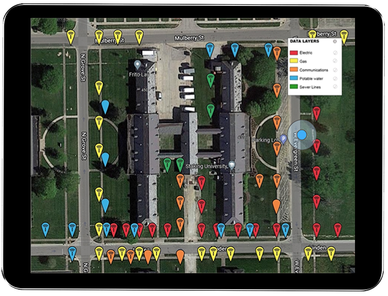
This study investigates a multi-factor technology solution to the root cause problem of inaccurate mapping and marking in the field. GIS and passive UHF RFID are two of the fastest-growing technologies in the world. This longitudinal study evaluates how RFID and magnetic in-field marker technologies, coupled with field-connected GIS, can mitigate costs and support future underground asset management needs. Study results show that these technologies deliver fast, reliable underground asset identification and improve field-to-office data management while delivering the durability to meet in-ground infrastructure marking requirements.