Damage prevention saves lives and money
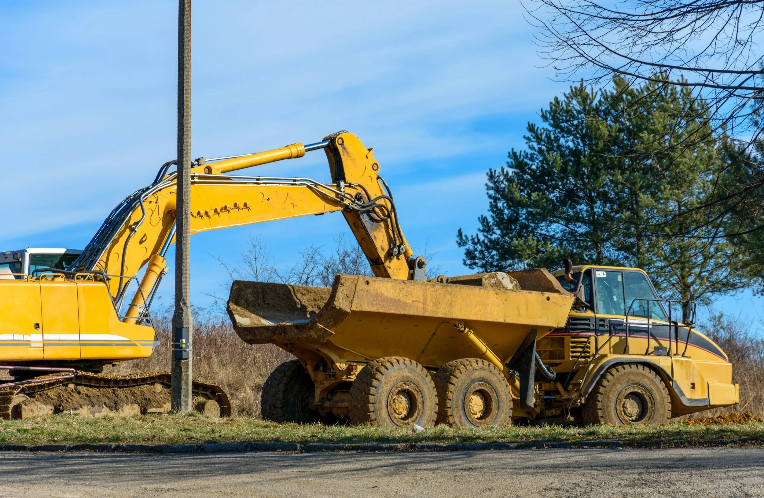
April is recognized by Congress and most Governors across the U.S. as National Safe Digging Month as shovels (and backhoes) hit the ground for a busy season. It’s well known that excavation is a dangerous business. Excavation strikes on public utility lines lead to more than 2,000 injuries and 400 deaths each year. The Common Ground Alliance (CGA) states that accidental utility strikes cost the U.S. at least $30 billion annually, based on self-reported data by stakeholders and state 811 call centers. And it looks like things are getting worse, not better.
April is recognized by Congress and most Governors across the U.S. as National Safe Digging Month as shovels (and backhoes) hit the ground for a busy season. It’s well known that excavation is a dangerous business. Excavation strikes on public utility lines lead to more than 2,000 injuries and 400 deaths each year[1]. The Common Ground Alliance (CGA) states that accidental utility strikes cost the U.S. at least $30 billion annually, based on self-reported data by stakeholders and state 811 call centers. And it looks like things are getting worse, not better.

From the CGA 2022 DIRT Report
Trends indicate more, not fewer damages
The CGA’s most recent data show that the number of incidents is increasing. A three-year trend (2020-2022) points to a 9.34 percent increase in utility strikes. With more than a half-trillion dollars allocated to new infrastructure in the U.S. over five years, it’s essential all organizations involved in excavation prioritize ways to reverse this dangerous and costly trend.
Many organizations are involved in excavation - professional excavators, landscapers, contractors, utilities, local, state and federal agencies, site owners and others. A single excavation site has dozens of contractors working in the same space at the same time. Surprisingly, there are few national guidelines for safe excavation processes, except for the one-call system established in 1994. This law directed states to have a phone number to call for underground locating. In most states, that number or link is 811.
Calling (or clicking on) 811 for locating services before excavation greatly reduces the risk of utility strikes. Unfortunately, nearly 25% of all reported utility damages result from NOT calling 811, as this chart from CGA shows.
An industry group, the Infrastructure Protection Coalition, is working to standardize the use of 811 by all parties involved in excavation. Their report states that

“A handful of states account for more than 20 percent of the national waste [related to 811], a combined $13 billion, because of 811 policies that lack teeth and, in some cases, do not require mandatory reporting of damage to utility lines. . . [The analysis shows that] these costs and the increased risk to public safety could be substantially reduced if states with the worst records adopted more effective practices and procedures already in use in other parts of the country.”
811 Emergency, National Report, 6/15/2022, Infrastructure Protection Coalition
Focus on policy
It appears that now is the time to call for a national approach to damage prevention. The CGA has just announced the formation of the Damage Prevention Action Center, an entity made up of industry leaders to advocate for data-driven legislative and regulatory policies and industry practices that protect our critical underground utility infrastructure and those who work and live near these important assets. It’s vital that legislation be based on data and best practices, and this group aims to ensure fact-based regulation.
Ambitious goals – achievable with technology
The CGA has set an ambitious goal of reducing damages by 50% over the next five years. Consistent and widespread use of 811 is key, but to reach that goal, other priority action areas must be leveraged. “For facility owners, GIS-based mapping of assets and communication are urgently needed to improve locating timelines and accuracy.”
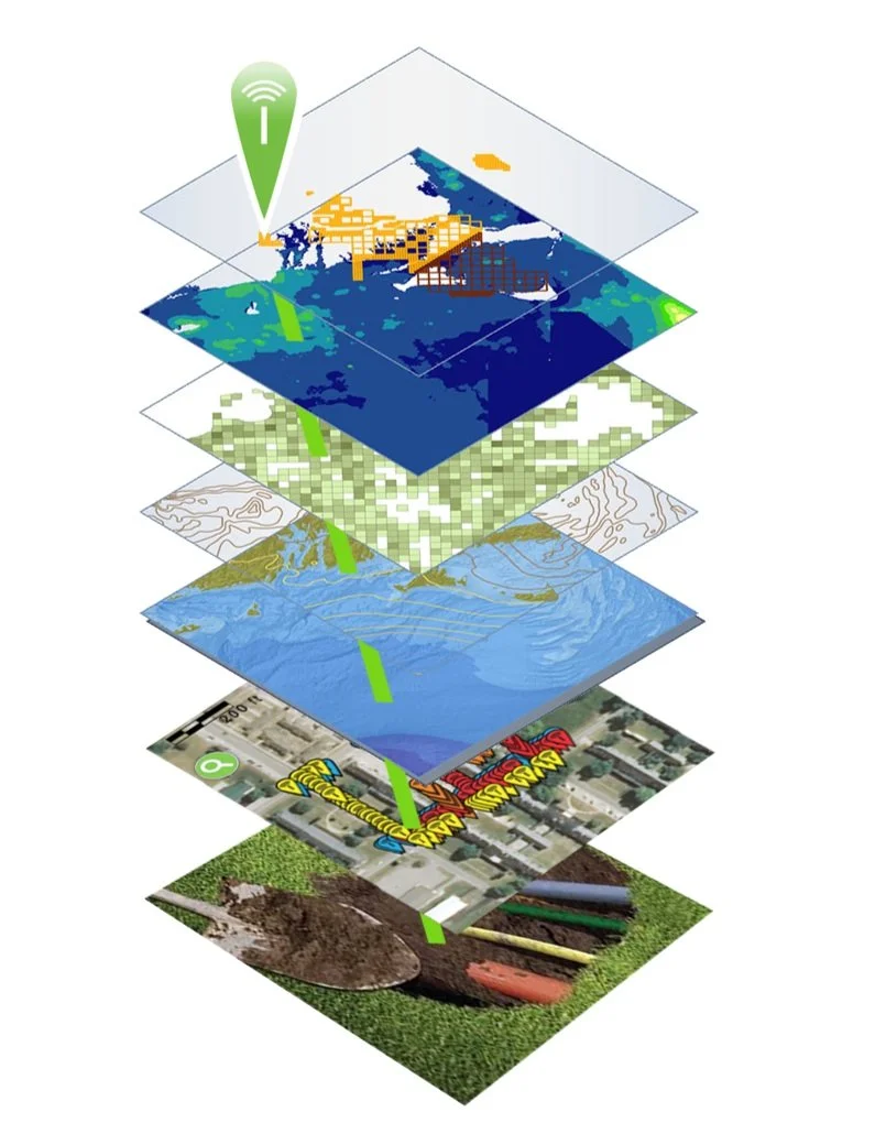
Geographic Information Systems (GIS) are already used extensively by municipalities and utilities across the country. These platforms are ideal for mapping and visualizing underground infrastructure and are already in use by many utilities and municipalities across the country.
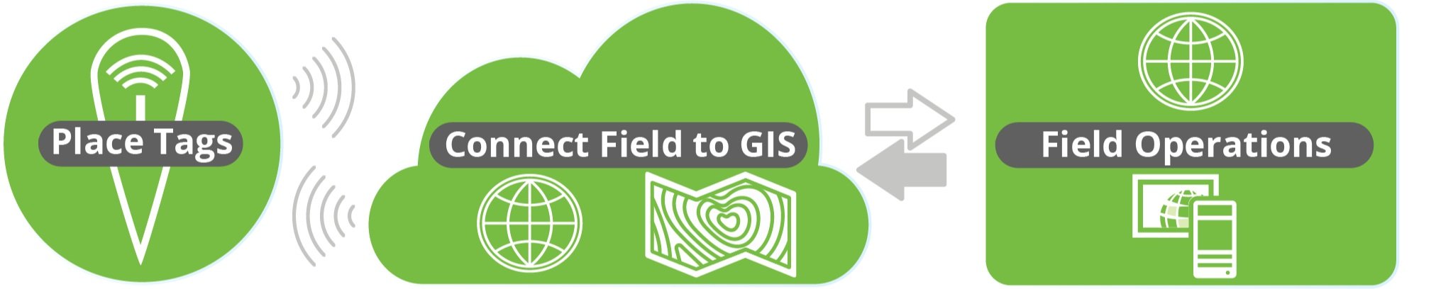
Adding processes for mapping underground utilities as they are they are installed (or uncovered by new excavation) can provide highly accurate, shareable maps for every contractor on a construction site. These efforts are already underway. For example, Esri, a global leader in GIS, delivers capabilities designed to make the visualization, identification, mapping and management of underground utilities accessible for all stakeholders. Its ArcGIS platform is ideal for generating accurate visual depictions of location and other data in layers. This platform uses data from a wide range of sources, including field operations. Field workers use cell phones or tablets to collect data in real time as they install underground infrastructure.
To ensure location data is absolutely accurate for future excavations, Esri offers the InfraMarker RFID app that integrates with its Field Maps or Survey123 field data collection software. As utilities are buried (or uncovered during excavation), RFID tags are placed on or near critical points, such as fiber junctions, valves, places where multiple assets converge and so on. Essential data about the asset, its owner and location data are written to each tag for future on site location and verification. This data is linked to ArcGIS via the InfraMarker/data collection apps, providing verified location data of the buried utility while also linking it to critical information about the asset, including video, schematics, maintenance and other data.

What this means is that in the future, when excavation on the same site is required, the exact location, owner and nature of underground assets can be verified on the spot. Buried RFID tags can be read before ground is broken from above using RFID readers connected to the Esri/InfraMarker data collection apps. Above ground RFID tags can also be read with a cell phone held close proximity to the tag.
The data owner can choose to share selected data with other contractors, preventing damage to their critical underground facilities during excavation.
Accurately mapping of underground assets is key to preventing damage. If used consistently, GIS and RFID deliver in-field location verification and identification data that streamline buried asset locating – preventing costly utility strikes and construction delays.
See it for yourself
Berntsen International supports CGA’s mission and will be showing InfraMarker RFID at the upcoming CGA Conference and Expo April 14-18 at the Broadmoor in Colorado Springs, Colorado in booth 322. We look forward to seeing you there!
References:
NP Case Study Minnesota Utilities Mapping (commongroundalliance.com)
https://www.linkedin.com/pulse/striking-balance-unearthing-facts-solutions-utility-line-machuca/
https://www.theutilityexpo.com/news/digging-safely-preventing-underground-utility-stri
https://www.amprobe.com/consequences-of-striking-underground-infrastructure/

Breaking News at the CGA Expo
April is Safe Digging Month ‒ for good reason. As the construction season ramps up, the number of utility strikes increases. According to the Common Ground Alliance (CGA), damages to underground utilities cost the U.S. an estimated $30 billion ‒ most caused by unintended strikes to utilities during excavation for construction projects. Unfortunately, few people are aware of this on-going problem until they lose power or internet when a backhoe strikes a cable – or when a gas line is struck, and the area is evacuated.

By Mike Klonsinski, Berntsen President
April is Safe Digging Month ‒ for good reason. As the construction season ramps up, the number of utility strikes increases. According to the Common Ground Alliance (CGA), damages to underground utilities cost the U.S. an estimated $30 billion ‒ most caused by unintended strikes to utilities during excavation for construction projects. Unfortunately, few people are aware of this on-going problem until they lose power or internet when a backhoe strikes a cable – or when a gas line is struck, and the area is evacuated.
CGA promotes safe digging by sharing practices and technologies that help prevent costly utility strikes. Additionally, the organization is a trusted source for data related to excavation damage across industries and regions.
Berntsen is a member of CGA and supports its goal of promoting safer digging practices by enhancing existing processes with existing technology. Its InfraMarker Connected RFID amplifies the power of GIS by connecting it with buried utilities via mobile apps.
Important new study results

Berntsen will be introducing the results of a seven-year longitudinal study of its Connected RFID technology at the upcoming CGA Annual Conference & Expo April 17 – 20 in Orlando, Florida. This presentation is a major step in addressing the national challenge of reducing costly utility strikes while improving the data of GIS-based infrastructure asset management platforms.
This study was produced in collaboration with Staking University and leverages Esri’s powerful ArcGIS platform. “We’re proud to be part of a movement to drive greater safety and efficiency in underground utility management,” said Mike Klonsinski, Berntsen president. “We’re especially excited to showcase the combination of technologies such as RFID (asset identification), magnetic locating and Esri’s ArcGIS system in our InfraMarker solution.”
The study findings and qualitative results will be presented in a session titled:
The presenters are experts in their respective fields
Mike Klonsinski, Berntsen president
Matt Streets, Planet Underground managing editor, a Staking University affiliate
Zachary Aguayo, Esri Senior Solution Engineer
Date & time:
Date: April 20th
Time: 10:15 – 11:00 am
Location: Rooms Bonaire 5-8 in the Caribe Royale in Orlando, Florida.
The presenters will cover the study results and their implications for utilities and other infrastructure assets.
Study Background
Berntsen collaborated on the study with Staking University (SU). Staking University is a state-of-the-art locator training program that focuses on utilities, municipalities, and private organizations – any organization that must locate and maintain buried infrastructure. Its Manteno, Illinois campus (that encompasses more than 20 acres of live and abandoned utilities) was the setting for the study. These real-world conditions make it the perfect site for staff training and for field testing products.
We hope to see you at this important meeting that seeks a common ground for organizations involved in building and maintaining the nation’s essential infrastructure.
Come and see us at the CGA exhibit hall:
Berntsen Booth 105
Staking University, Booth 713

National 811 Day - little known but important!
It’s National 811 Day – a very important, but little-known commemoration. Anyone who is planning to disturb the ground should call this number before digging or excavating – or go to call811.com and connect online. Once you provide the area of excavation, locators will come out and mark the location of buried gas pipes, water lines, power cables and other underground utilities.

It’s National 811 Day – a very important, but little-known commemoration. Anyone who is planning to disturb the ground should call this number before digging or excavating – or go to call811.com and connect online. Once you provide the area of excavation, locators will come out and mark the location of buried gas pipes, water lines, power cables and other underground utilities.
This call can save your (or someone else’s) life. According to the Pipeline and Hazardous Materials Safety Administration (PHMSA), ruptured gas distribution systems have killed 12 people already this year. Since 2005, 225 people have died due to damages to gas distribution systems, with total damages to public and industry property of nearly $8.5 billion*. These are the statistics for the gas distribution industry alone.
For firms that are excavating every day, the need to “Know what’s below” is essential for safe operations.
The 2020 DIRT Report (Damage Information Reporting Tool) provides a more comprehensive picture of damages caused by all types of underground utility strikes – though the reporting is voluntary, not mandatory. The Common Ground Alliance (CGA) estimates that utility strikes result in $30 billion of direct and indirect costs every year. The most common root cause listed for these utility strikes was “failure to notify” (they didn’t call 811) before excavation.
The top five root causes of damage (70% of all reported damages):

No 811 call
No test hole dug for verification (pothole)
Facility marked inaccurately due to abandoned facility
Facility not marked due to excavator error
Excavator failed to maintain clearance for verifying marks
The truth is that no one knows how much damage results from excavation errors. In many sectors, there are no legal requirements for reporting utility strikes. Although a growing number of companies are voluntarily reporting, the data provides a very incomplete picture.
Until uniform processes and regulations are developed for marking and managing underground utilities, many utilities, construction companies and data centers are leveraging technology to “know what’s below”.
Geographic Information Systems (GIS) + Radio Frequency Identification (RFID)

GIS is a game-changing technology that is seeing explosive growth in many sectors, because it allows users to visualize data spatially. Passive RFID is the fastest growing identification technology and is also incredibly versatile – it provides a unique ID that can be tied to any type of data.
The convergence of these two technologies is fueling a new approach to managing utilities, called InfraMarker Connected RFID. GIS provides the maps, and InfraMarker RFID provides the location and asset verification essential to repair and maintenance crews in the field.
RFID delivers a direct connection between the buried asset and the geospatial map that is being used to locate the asset. Geospatial data is very good at visualizing an underground utility, but these visualizations don’t always provide the accuracy that is required in the real world, where a utility strike could result in a project delay (or disaster).
RFID provides field crews the two-factor verification that proves the identity and location of the scanned asset – even below ground. Esri’s Survey123 and Field Maps field data collection apps incorporate this highly accurate data into existing workflows. It is a game-changer for installation and maintenance crews, because now they can “know what’s below”.
How it works
It’s simple – an RFID tag is affixed on or near an asset (above or below ground). Each RFID tag has a unique ID that is linked to that asset’s record in GIS. Once linked, a field technician can scan a tag and automatically load that asset’s specific record for updating. No need for a line of sight with RFID, so this makes InfraMarker perfect for underground utilities.
The advantage of InfraMarker RFID is the accuracy it delivers to help utilities better manage their infrastructure assets. A value-add is that this data could also help prevent excavation strikes, helping everyone “Know what’s below”.
Until every buried utility is marked with InfraMarker RFID, it’s essential to call 811 before excavation – it can be a matter of life and death!
Give InfraMarker a try with our new Starter Kit!
Interested? Contact - info@inframarker.com