
Public Works — Key to civilization
Public works have been around ever since people found ways to ensure a reliable source of water for their crops. In 4000 BC, the ancient Sumerians created a successful irrigation system that watered fields between the Tigris and Euphrates Rivers.
What does the term “Public Works” mean? It’s one of those terms that are so broad that it almost defies definition.
The American Public Works Association (APWA) says “Because of the multi-faceted, ever-evolving nature of public works, we may never arrive at a final definition but, for now, the following definition seems appropriate: Public works is the combination of physical assets, management practices, policies, and personnel necessary for government to provide and sustain structures and services essential to the welfare and acceptable quality of life for its citizens.”

Haghe, L. & Roberts, D. (1849) Excavated mansions of Petra, Petra, March 7. Extinct City Petra, 1849. [Published] [Photograph] Retrieved from the Library of Congress.
A Long History

By Saqib Qayyum - Own work, CC BY-SA 3.0,
A 2.4m deep, 12m long, and 7m wide pool known as "The Great Bath" is located at the centre of the Citadel, is made of fine baked waterproof mud bricks and a thick layer of bitumen. It is the earliest public water tank of the ancient world. Adjacent to it are a well that was used to supply water to the bath.
Public works have been around ever since people found ways to ensure a reliable source of water for their crops. In 4000 BC, the ancient Sumerians created a successful irrigation system that watered fields between the Tigris and Euphrates Rivers. In Mohenjo‐Daro, a major urban center of the Indus Civilization (India), a sophisticated system for supplying water and expelling sewage dates back to the mid-third millennium BC. Water came from more than 700 wells and supplied not only domestic demands but also a system of private baths and a Great Bath for public use. Drains and sewers were carefully constructed to facilitate the removal of waste.[1]
Beginning in 586 BC, the Nabataeans, who lived in northern Arabia and the southern Levant, created a sophisticated water collection system which allowed them to build an impressive trade empire in the heart of arid Arabia.[2]
Of course, everyone knows about the Romans, who constructed roads, harbor works, aqueducts, temples, forums, town halls, arenas, baths, and sewers – many of which are still seen today, more than 2,000 years later. These public works were designed to stabilize and strengthen the empire and make the lives of Roman citizens better.
Recent history

Segovia--El Puente. Segovia Spain, None. [Between 1900 and 1910] [Photograph] Retrieved from the Library of Congress.
Fast forward a couple thousand years, and public works became key to stabilizing the American economy during a time of crisis. Back in 1933, the federal government undertook a massive public works effort to counteract the devastating effects of the Great Depression. For a decade, the federal government poured $3.8 billion through the Public Works Administration (PWA) into projects that radically transformed the country’s infrastructure. Prominent projects included New York’s Triborough Bridge, Grand Coulee Dam, the San Francisco Mint, Reagan National Airport and Key West’s Overseas Highway.[3]
Later, in 1935, President Roosevelt used an executive order to create the Works Progress Administration (WPA). At the time, unemployment was holding steady at 20 percent, and the economy needed a serious boost. The WPA employed mostly unskilled men to carry out public works infrastructure projects. They built more than 4,000 new school buildings, erected 130 new hospitals, laid roughly 9,000 miles of storm drains and sewer lines, built 29,000 new bridges, constructed 150 new airfields, paved or repaired 280,000 miles of roads and planted 24 million trees to alleviate loss of topsoil during the Dust Bowl. Over the course of 10 years, the WPA put 8.5 million people to work, strengthening communities and laying the groundwork for the largest industrial expansion in history -- the wartime economy of 1945.
The Infrastructure Investment and Jobs Act

Grand Coulee dam construction. , None. [Between 1936 and 1946] [Photograph] Retrieved from the Library of Congress.
Today, the country is in the midst of another massive public works investment. The Infrastructure Investment and Jobs Act (IIJA) was signed into law on November 15, 2021. The IIJA is an historic investment in our nation’s infrastructure: $1.2 trillion over five years, including $550 billion in new federal spending, including --
passenger and freight rail;
highway and pedestrian safety;
public transit;
broadband;
ports and waterways;
airports;
water infrastructure;
power and grid reliability and resiliency;
resiliency, including funding for coastal resiliency, ecosystem restoration, and weatherization;
clean school buses and ferries;
electric vehicle charging;
addressing legacy pollution by cleaning up Brownfield and Superfund sites and reclaiming abandoned mines; and
Western Water Infrastructure[4]
The American Public Works Association (APWA)

The APWA is an organization that was founded to help public works professionals improve their skills, share information and work together to find the best ways to help their communities. Along with comprehensive training programs and other resources, the APWA helps its members learn about and apply for funds provided by the Infrastructure Investment and Jobs Act.
Each year, the APWA organizes a conference and exposition to help keep its members informed. This year’s conference, held in San Diego, includes 125 technical and professional development sessions using the latest learning models: classroom, interactive, and "live" learning labs. Additionally, more than 400 companies will be exhibiting the latest technology – including Berntsen International’s InfraMarker Connected RFID in booth 1939.
InfraMarker is key to smooth operations
Today, public works is more complex than ever. Even in small cities, more and more organizations are relying on the power of GIS to help manage their assets and streamline operations. InfraMarker RFID is designed to leverage the power of GIS to accurately mark and manage any type of asset - directly from the asset point itself. Each passive RFID marker identifies the asset, connecting to GIS with a simple scan, providing verified asset identity and launching the the associated workflow. This instant asset confirmation of ]identity removes guess-work from field maintenance and speeds routine inspection and maintenance with accurate documentation.
We invite all public works professionals who manage infrastructure assets to see how InfraMarker RFID can improve asset management by providing verified field asset information that links to any GIS system. Sign up here to chat with Brent Sherman, our Sales Manager for a live demo of how InfraMarker can work for you at the APWA Conference, booth 1939, August 27-29.
See how it works:

References:
[2] https://www.ancient-origins.net/artifacts-ancient-technology/nabateans-002193
[3] https://livingnewdeal.org/glossary/public-works-administration-pwa-1933-1943/
Sources:
https://livingnewdeal.org/glossary/public-works-administration-pwa-1933-1943/
http://www.waterencyclopedia.com/Tw-Z/Water-works-Ancient.html#ixzz89u0Sv4uO

IT'S NATIONAL 811 DAY!
Today is National 811 Day – we are reminded to call 811 (or visit call811.com) before digging – in our yards or at a construction site. This simple reminder has saved lives and repair costs by preventing accidental damage to power lines, gas lines and other buried utilities during excavation.
A Blog by Emily Pierce, PLS, CFedS

“Notification NOT Made” was the single greatest root cause, selected for 23% of damages submitted. Although we continue to make progress, this root cause has hovered around 25% for the past six years.
“Notification NOT Made” was the single greatest root cause, selected for 23% of damages submitted. Although we continue to make progress, this root cause has hovered around 25% for the past six years.
Today is National 811 Day – we are reminded to call 811 (or visit call811.com) before digging – in our yards or at a construction site. This simple reminder has saved lives and repair costs by preventing accidental damage to power lines, gas lines and other buried utilities during excavation.
While we know that 811 has some inefficiencies, it is the best first line of defense for damage prevention for a property owner and the utility. Without proper locating subsurface utilities before excavation, the results can be costly.
Unfortunately, according to the latest DIRT Report (Damage Information Reporting Tool), the most frequent root cause of excavation damage was “failure to notify the one call center.” This cause of excavation damage is the most preventable. It’s also free for the reporter, so it’s also the most cost effective.
The cost estimate of not making the call to 811 is just that – an estimate. The United States lacks a requirement to report excavation incidents, so no one really has the data. Likewise, most states have a one-call center that’s funded and run by the utility partners themselves. Tracking excavation incidents across the board may not be compiled completely, or done on an individual utility company basis and not shared publicly. However, the Common Ground Alliance (CGA) has a reporting system that incorporates both voluntary and required submissions that offers a look into the root cause excavation damages.
It’s interesting to have a look at what it costs not to locate underground utilities.
According to a recent white paper by Geoff Zeiss and Dr. Sakuran Shinoaki, the cost (direct and indirect) of utility damage in the U.S. is $50-100 billion annually. The range is so broad because we don’t have a required or comprehensive reporting system. We actually don’t know how many excavating accidents happen and what they cost.
The paper goes on to present examples of utilities using mapping / modeling technologies to accurately model underground infrastructure. Recent advances in technology mean that ground penetrating radar and LiDAR can be used by surveyors to effectively capture underground infrastructure. When combined with GIS and other emerging technologies, accurate images of buried utilities could save billions of dollars annually and prevent loss of life.
Why isn’t more being done to accurately map buried infrastructure?
“IT HAS BEEN ARGUED THAT LIABILITIES MAY BE THE SINGLE MOST IMPORTANT KEY TO IMPROVING THE QUALITY OF LOCATION INFORMATION ABOUT UNDERGROUND INFRASTRUCTURE.”
The most interesting paragraph in this paper points to the reason why no coordinated effort exists to create an accurate and comprehensive reporting system. “It has been argued that liabilities may be the single most important key to improving the quality of location information about underground infrastructure.” I assume this means that if accurate information exists, then it might actually increase the financial risk of those involved in an excavation accident. This is disheartening as the cost paid isn’t always financial. There have been lives lost and injuries sustained, which carries a bigger burden than just money.
However, there is hope, as “some jurisdictions are implementing policies for shared liabilities to motivate all stakeholders to become involved in capturing and sharing better data about underground infrastructure to reduce risk.”
Additionally, I’ve spent the last few years lobbying on Capitol Hill with other members of the National Society of Professional Surveyors (NSPS) for the importance of accurate geospatial data for infrastructure projects. NSPS has taken a very active role with the importance of accurate geospatial data to be required for all infrastructure projects, including the physical framework of transportation, energy, communications, water supply, and other systems.
Opportunity for surveyors
Fortunately, industry-wide, there is a trend toward acknowledging the need for accurate underground infrastructure data and organizations are adopting new technologies to conduct underground surveys. A number of organizations are encouraging surveyors to become qualified in these new technologies and learn how to apply them in underground surveys. Along with GIS, LiDAR and GPR, other tools are making the job of underground surveying much easier. For example, an existing technology is now being used to tie physical assets to the data in GIS. For the past decade, Berntsen has been developing RFID to work with existing GIS platforms. The InfraMarker RFID solution is now being used to mark assets in the field and tie that specific location to the asset record in GIS. That means that with a simple RFID scan, a surveyor or field technician can identify each specific asset and access its record in the field, update the information and have that data instantly available in the GIS, accessible for locating, tracking, maintenance scheduling, planning and more.
So what needs to change?
Well, I think we all have a hand to play.

First, property owners have the responsibility to call 811. This ensures that first line of defense and reduces their risk of liability if something is damaged.
Then, utility locators have the responsibility to find ways to improve the speed and accuracy of locating. This likely includes increasing staff and resources so that the right people are available for quick marking turnaround.
Additionally, utility owners have the responsibility to invest in safety practices and technology that increases the accuracy of asset mapping/locating. This is an important step especially during the installation of new underground utilities. Accurate marking and mapping will protect infrastructure investments in the future. Surveyors are the key component to providing that accurate information to utilities.
It’s 811, and a great day to be a surveyor! We have the opportunity to make the world a better and safer place. I’m looking forward to helping the world “know what’s below.”
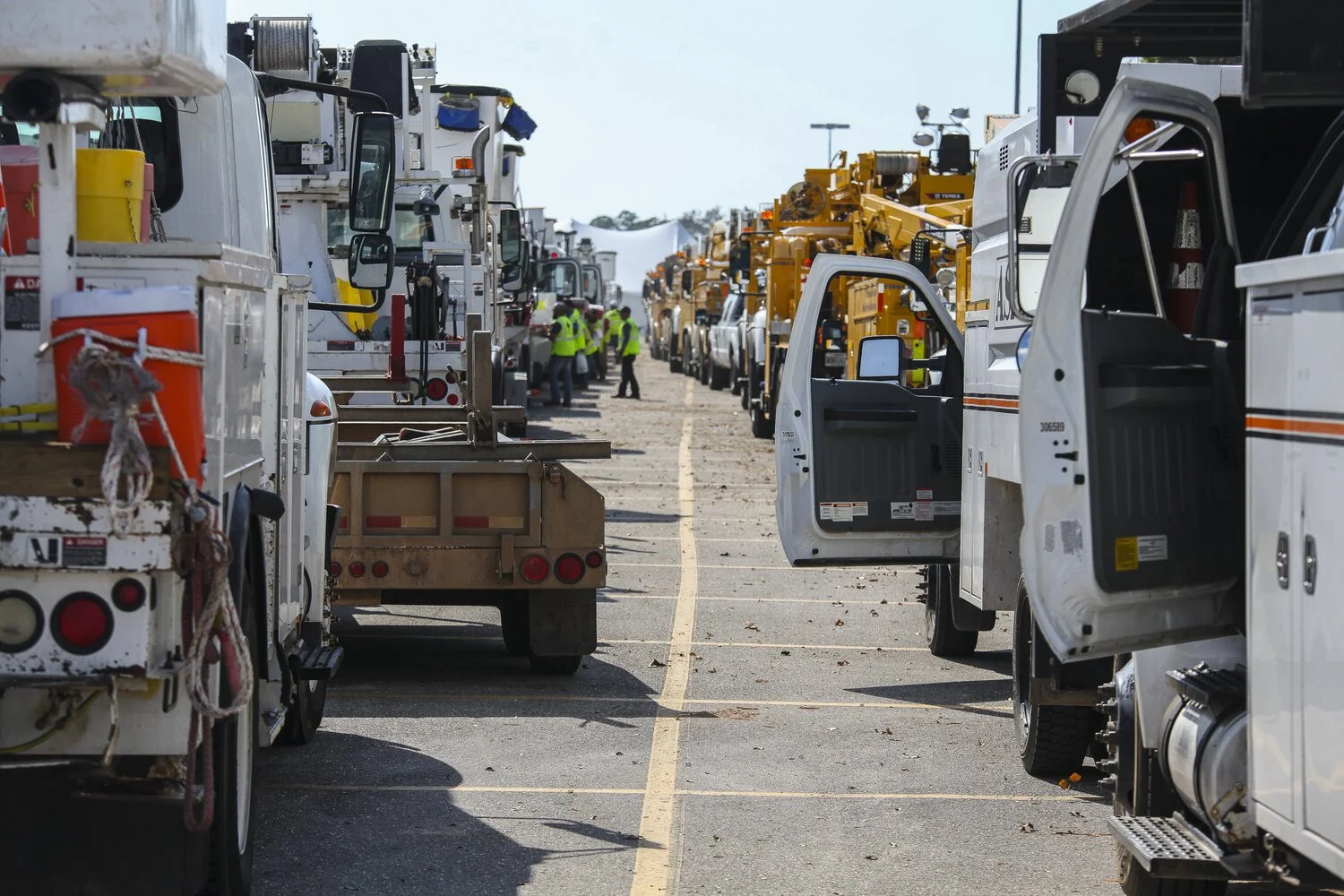
RFID Expedites Recovery
Disasters run the gamut, from environmental factors to cyber-threats to aging infrastructure. Keep in mind America receives an overall grade of D+ on the American Society of Civil Engineers Infrastructure Report Card, with the categories of drinking water, energy, and wastewater receiving a D or D+ mark.
Disasters Underscore Critical Need for Connected Utility Infrastructure
Digital Mapping Expedites Disaster Recovery, Has the Potential to Save Lives
On Sept. 14, 2018, Hurricane Florence slammed into the Carolinas, bringing with her powerful winds, torrential rains and the potential to wreak catastrophic destruction. Though Florence was downgraded to a Category 1 storm as it moved over land, its high winds and rain toppled trees, triggered massive flooding and caused power transformers to explode like fireworks, leaving hundreds of thousands of people without power. More than 40 people have died as a result of the storm and flooding.
A day earlier, 800 miles up the East Coast, another disaster had occurred. Dozens of rapid-fire gas explosions caused 70 home fires and one fatality in what one official described as “Armageddon.” Entire neighborhoods north of Boston were forced to evacuate, and firefighters and crews scrambled to fight the flames and shut off the gas and electricity to the affected areas. The fires were caused when too much natural gas was pumped into a section of pipe and then leaked into homes.

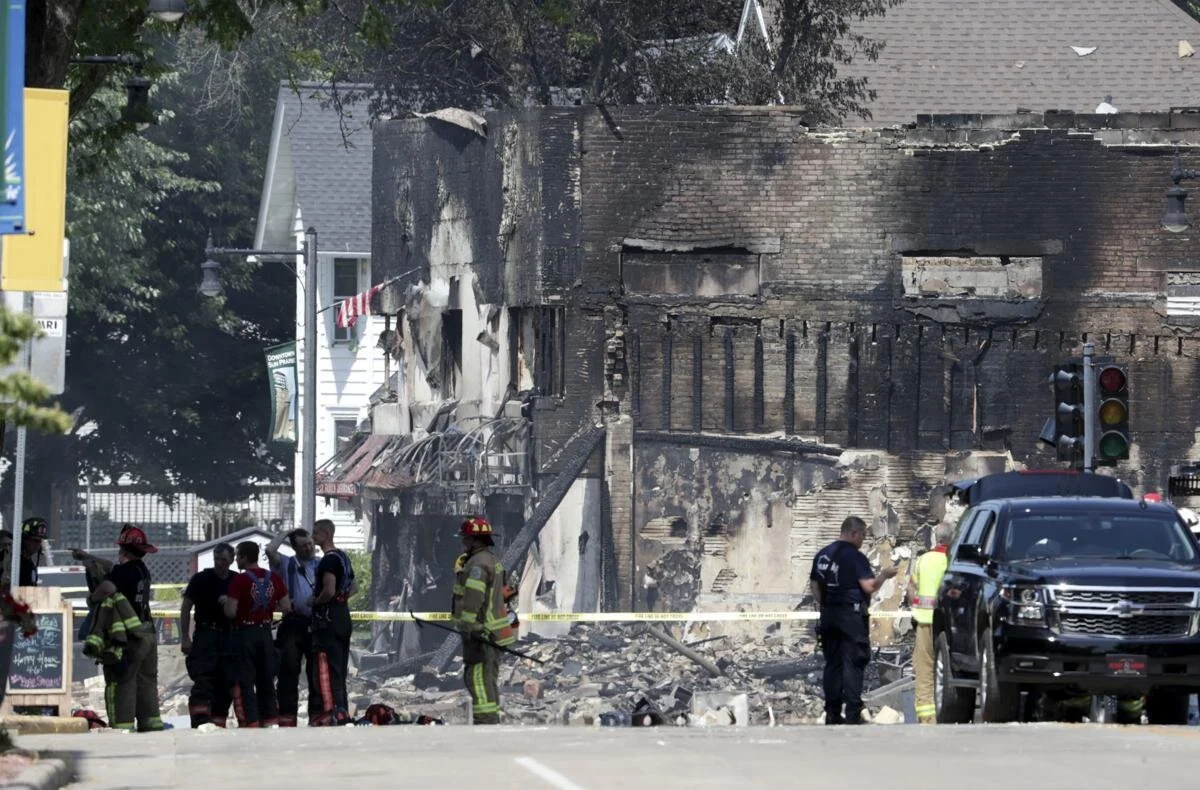
These disasters—and others including the California wildfires and Hurricanes Harvey and Irma—are a cogent reminder of the critical need to upgrade and digitize our utility infrastructure. This is especially relevant for all of us at Berntsen who live and work in Wisconsin, where a massive explosion destroyed a city block in downtown Sun Prairie and killed a volunteer firefighter in July. The fact that we design equipment that might have prevented this disaster and so many others saddens us, and this tragedy has deeply affected our employees.
Disasters on the Rise

Disasters run the gamut, from environmental factors to cyber-threats to aging infrastructure. Keep in mind America receives an overall grade of D+ on the American Society of Civil Engineers Infrastructure Report Card, with the categories of drinking water, energy, and wastewater receiving a D or D+ mark.
A 2017 report prepared by Johns Hopkins University notes that the U.S. insurance industry has identified a $20 to $55 billion annual financial loss from power outages caused by flooding, hurricanes, and extreme temperatures. A combination of “higher average global temperatures, more destructive storms, and hurricanes, and increased risk of wildfire will ultimately worsen risk exposure for utilities,” the report states.
Many public and private utilities have state-of-the-art asset management systems to tackle the challenge of disasters, but the widespread deployment of these systems is lacking in much of the country, putting communities and citizens at greater risk. Over time, failure to adopt digital technologies will lead to slower disaster recovery times, potentially greater loss of life and bigger financial losses to business and the public.
“Over time, failure to adopt digital technologies will lead to slower disaster recovery times, potentially greater loss of life and bigger financial losses to business and the public. ”
The good news is digital transformation is coming to the utility industry and innovative technologies already exist to improve disaster planning, response, recovery, and underground asset management.
Connected Marking and Digital Mapping Are a Game Changer

Disasters such as storms, wildfires, explosions, and earthquakes often require gas, water, electric and telecommunications companies to quickly identify, locate and access underground utility assets.
In August 2017, a major fiber network outage in Atlantic Canada shut down cellphone and Internet service, closed some bank branches and delayed flights at multiple airports. The problem was caused when two fiber optics lines were cut during construction work.
The ability to quickly locate and repair underground utility assets is often hampered by outdated maps and inaccurate data. During a disaster, these delays can be devastating and deadly.
Connected marking solutions for utility infrastructure such as the InfraMarker® system from Berntsen International are a game changer for asset management and extremely helpful in disaster recovery. In a disaster, utility crews can use the InfraMarker mobile app and digital mapping software to quickly find the exact location of a gas pipeline shut-off valve to prevent an explosion. It’s that powerful.
This unique combination of RFID, mobile app and digital mapping software significantly expedites underground utility locating.
InfraMarker is a secure and easy way to collect and relay essential utility asset data. From there, the data can be accessed on smartphones and by popular GIS systems such as ArcGIS. Going forward, connected marking solutions will play an integral role in Smart City utility asset management.

In the past, the most important part of infrastructure management was to locate the asset. Today, infrastructure management requirements are greater and more complex. Location and other relevant data need to be available to multiple users faster—ideally in real-time—and to be integrated with GIS, ERP, workflow management and regulatory/compliance systems.
RFID is a highly effective tool for precision locating. But the key advantage of connected marking is the ability to collect, store and share asset data via the cloud. This next-gen innovation delivers exceptional benefits and ROI to utility asset managers, emergency responders, and citizens, and also has the potential to save lives.

RFID Expedities Recovery
Disasters run the gamut, from environmental factors to cyber-threats to aging infrastructure. Keep in mind America receives an overall grade of D+ on the American Society of Civil Engineers Infrastructure Report Card, with the categories of drinking water, energy, and wastewater receiving a D or D+ mark.
Disasters underscore critical need for connected utility infrastructure
Digital mapping expedites disaster recovery, has the potential to save lives
On Sept. 14, 2018, Hurricane Florence slammed into the Carolinas, bringing with her powerful winds, torrential rains and the potential to wreak catastrophic destruction. Though Florence was downgraded to a Category 1 storm as it moved over land, its high winds and rain toppled trees, triggered massive flooding and caused power transformers to explode like fireworks, leaving hundreds of thousands of people without power. More than 40 people have died as a result of the storm and flooding.
A day earlier, 800 miles up the East Coast, another disaster had occurred. Dozens of rapid-fire gas explosions caused 70 home fires and one fatality in what one official described as “Armageddon.” Entire neighborhoods north of Boston were forced to evacuate, and firefighters and crews scrambled to fight the flames and shut off the gas and electricity to the affected areas. The fires were caused when too much natural gas was pumped into a section of pipe and then leaked into homes.
These disasters—and others including the California wildfires and Hurricanes Harvey and Irma—are a cogent reminder of the critical need to upgrade and digitize our utility infrastructure. This is especially relevant for all of us at Berntsen who live and work in Wisconsin, where a massive explosion destroyed a city block in downtown Sun Prairie and killed a volunteer firefighter in July. The fact that we design equipment that might have prevented this disaster and so many others saddens us, and this tragedy has deeply affected our employees.
Disasters on the rise
Disasters run the gamut, from environmental factors to cyber-threats to aging infrastructure. Keep in mind America receives an overall grade of D+ on the American Society of Civil Engineers Infrastructure Report Card, with the categories of drinking water, energy, and wastewater receiving a D or D+ mark.
A 2017 report prepared by Johns Hopkins University notes that the U.S. insurance industry has identified a $20 to $55 billion annual financial loss from power outages caused by flooding, hurricanes, and extreme temperatures. A combination of “higher average global temperatures, more destructive storms, and hurricanes, and increased risk of wildfire will ultimately worsen risk exposure for utilities,” the report states.
Many public and private utilities have state-of-the-art asset management systems to tackle the challenge of disasters, but the widespread deployment of these systems is lacking in much of the country, putting communities and citizens at greater risk. Over time, failure to adopt digital technologies will lead to slower disaster recovery times, potentially greater loss of life and bigger financial losses to business and the public.
The good news is digital transformation is coming to the utility industry and innovative technologies already exist to improve disaster planning, response, recovery, and underground asset management.
Connected marking and digital mapping are a game changer
Disasters such as storms, wildfires, explosions, and earthquakes often require gas, water, electric and telecommunications companies to quickly identify, locate and access underground utility assets.
In August 2017, a major fiber network outage in Atlantic Canada shut down cellphone and Internet service, closed some bank branches and delayed flights at multiple airports. The problem was caused when two fiber optics lines were cut during construction work.
The ability to quickly locate and repair underground utility assets is often hampered by outdated maps and inaccurate data. During a disaster, these delays can be devastating and deadly.
Connected marking solutions for utility infrastructure such as the InfraMarker® system from Berntsen International are a game changer for asset management and extremely helpful in disaster recovery. In a disaster, utility crews can use the InfraMarker mobile app and digital mapping software to quickly find the exact location of a gas pipeline shut-off valve to prevent an explosion. It’s that powerful.
This unique combination of RFID, mobile app and digital mapping software significantly expedites underground utility locating.
InfraMarker is a secure and easy way to collect and relay essential utility asset data. From there, the data can be accessed on smartphones and by popular GIS systems such as ArcGIS. Going forward, connected marking solutions will play an integral role in Smart City utility asset management.
In the past, the most important part of infrastructure management was to locate the asset. Today, infrastructure management requirements are greater and more complex. Location and other relevant data need to be available to multiple users faster—ideally in real-time—and to be integrated with GIS, ERP, workflow management and regulatory/compliance systems.
RFID is a highly effective tool for precision locating. But the key advantage of connected marking is the ability to collect, store and share asset data via the cloud. This next-gen innovation delivers exceptional benefits and ROI to utility asset managers, emergency responders, and citizens, and also has the potential to save lives.

Image credit: FEMA - Utility Trucks and Crews Line up To Help

Image credit: Wisconsin State Journal
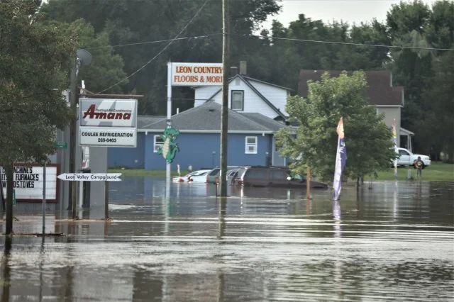
Image credit: US Army
Over time, failure to adopt digital technologies will lead to slower disaster recovery times, potentially greater loss of life and bigger financial losses to business and the public.